


Live World Map: Satellite View
3.080.00 Reviews
App Specs
- Version
- 16.1.16_20260821
- Updated On
- License
- Free
- Downloads
- 1,000,000+
- Developer
- SING HAI CORPORATION PTE. LTD.
- Categories
- Maps & Navigation
- Platform
- Android
Screenshots
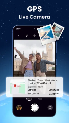
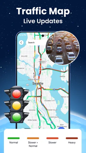
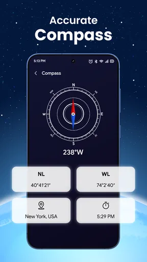
 Analysis by AppCompare
I tend to reach for a world map app for two different reasons: to find my way through a place I don’t know, or simply to see what a distant place looks like. Live World Map: Satellite View aims to bring those uses together, pairing map exploration with GPS and street navigation. I find that combination appealing, though it matters whether you want a practical route planner or a way to browse the planet from your phone.
What free access means in practice
The app is free to install, so you can try its basic experience without paying upfront. There are in-app purchases, with items listed from $1.99 to $14.99, so free access should not be confused with every option being free. I’d start by exploring the app before considering a purchase, then decide whether anything offered solves a real need for you. I wouldn’t pay simply because a feature sounds appealing; first check that it fits the way you actually use maps.
That distinction is useful if you only want to open a map occasionally, look around a destination, or check your position. For regular navigation, I’d first test the route experience on journeys I already know rather than relying on a new app for an important trip straight away. That gives you a fair sense of whether its instructions and map views work for you without making a purchase part of the decision.
A map for looking around as well as getting there
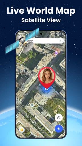
The appeal here is the mix of visual exploration and navigation. Satellite imagery can help you understand the broad shape of a location before you arrive, while a street-oriented view is more useful when you need to follow roads. Terrain view offers another way to read the landscape. Switching between these perspectives is more useful than treating one map style as the answer to every question: an overhead image can clarify the layout of a neighborhood, but a street map is generally easier to follow when you’re moving through it.
A practical workflow is to look at a destination from above first, then switch to the road-focused view when you’re ready to work out how to get there. I’d use the satellite view to get a sense of the surrounding area, not as proof that a doorway, path, or entrance will be easy to find. Images and map labels serve different purposes, and visual detail doesn’t automatically make navigation more precise.
Where it fits beside familiar map apps
Compared with the map app already on your phone, this one is most interesting when you want a globe-like way to browse and compare map views. A dedicated navigation app may be a better everyday choice if your priority is dependable turn-by-turn guidance, familiar saved places, or a well-established routine. I wouldn’t switch your main navigation app based on satellite imagery alone; I’d compare how each handles a route you know and how quickly you can understand the screen while moving.
For a quick look at a faraway landmark, a classroom conversation, or an early look at a holiday area, the exploratory side can be the point. For time-sensitive directions in an unfamiliar city, I’d keep a trusted alternative available until you’ve tested this app for yourself. That isn’t a knock on the map views; it’s a sensible distinction between browsing a place and depending on guidance to reach one.
Worth Reading Before You Choose

EA SPORTS FC Mobile 26 Is a Bigger Football Game, but It Takes Time

Flipboard Shows What News Apps Must Do Beyond the Feed

Switching to Android Auto Means Rethinking Your Driving Routine

Google Calendar Makes a Crowded Week Easier to Manage

Ludo King Makes the Most of the Minutes Between Plans

Baby Panda World Brings Quick Play to Modern Phones, but Its Game Library Feels Busy
The app is published by SING HAI CORPORATION PTE. LTD. and sits in the maps and navigation category. It has an average rating of 3.3 from around 1.9 thousand ratings, with more than 1 million installs. Those figures suggest it has attracted a sizeable audience, but they don’t tell me whether it will suit a particular phone, route, or travel habit. I’d treat ratings as background and judge the actual experience against the task I need it to do.
Exploring the World from Your Screen
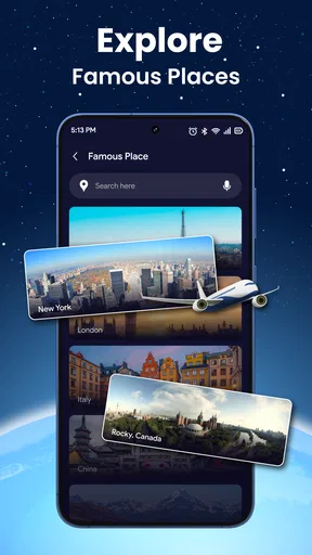
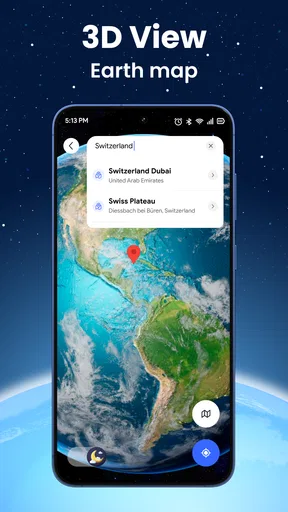
First things first, this app is like having a mini planetarium in your pocket. Once you fire it up, you're greeted with a sleek, interactive globe that feels almost tangible. The app lets you zoom in, spin around, and explore the world in vivid detail. I mean, who wouldn't want to sneak a peek at the Eiffel Tower or the Grand Canyon without hopping on a plane?
Features That Make You Go "Wow"
So, what makes Live World Map: Satellite View stand out from the crowd? For starters, it's packed with some pretty rad features. You can switch between various map views, including satellite, street, and terrain. Fancy seeing the world at night? The night mode lights up cities like stars scattered across the universe.
And let's not forget about real-time updates. The app constantly refreshes to show the latest images, so you're always in the loop. Whether you're checking out the weather patterns in your area or stalking the Northern Lights, it’s like being a part of a global adventure club.
Getting Down to Business
Now, I know you might be wondering about the nitty-gritty. Is it user-friendly? Does it gobble data like a hungry hippo? Well, let me tell you, the interface is as smooth as butter. Navigating through the app is a breeze, with intuitive controls that even my grandma could master. Plus, it’s optimized to be light on data usage, so no worries about burning through your monthly plan.
Another cool bit? The app supports multiple languages, making it super accessible for globe-trotters from all corners of the earth. It's like they thought of everything!
Perfect for the Curious Souls
What I love most about Live World Map: Satellite View is how it caters to the curious minds out there. Whether you're a geography geek, an aspiring traveler, or just someone who loves to explore, this app has something for everyone. You can use it for educational purposes or just to satisfy your curiosity about what's happening on the other side of the planet.
Imagine planning your next vacation with a bird's-eye view of your destination. Or maybe you’re just in the mood for a virtual getaway. Either way, this app has got you covered.
Wrapping Up Our Virtual Journey
In a world where technology can sometimes feel overwhelming, it's refreshing to find an app that genuinely enhances your experience without complicating things. Live World Map: Satellite View is a delightful mix of education and entertainment, wrapped up in a user-friendly package.
So, the next time you feel that itch to explore but can't quite pack your bags, remember that the world is just a tap away. Dive into the app, and let your imagination take flight. Happy exploring!
A realistic way to use it before a trip
Picture a weekend trip to a city you’ve never visited. Before leaving, I’d use the map to orient myself around the hotel and the places I hope to see, then compare the satellite and street views to get a feel for how the area is laid out. Once I’m walking, I’d use navigation for the route itself and keep an eye out for ordinary street signs. The map can help me arrive with a better mental picture, but I wouldn’t assume an overhead view will show temporary closures, current crowds, or every entrance clearly.
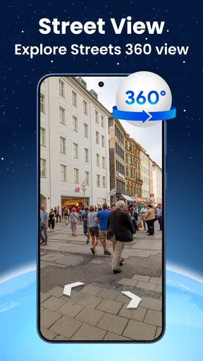
There’s a useful planning habit here: look at the destination at more than one zoom level. A close view can make a block look simple while hiding how it connects to the wider area; zooming out helps me see nearby roads and landmarks before I commit to a route. Then I’d switch to street view for the final approach. This small sequence makes the imagery more useful without asking it to replace local signs or common sense.
Questions worth answering before relying on it
Can it replace a familiar navigation app? I wouldn’t assume so. If you depend on a particular app for daily commuting, test this one on a short, familiar journey first and compare the route instructions, readability, and overall ease of use. A map that is enjoyable to explore is not automatically the one I’d choose when being late has consequences.
Is satellite imagery the same as a live camera view? No: I’d treat satellite imagery as a map perspective, not as a window that shows what is happening on a street at this moment. Likewise, viewing a landscape or city at night is an interesting way to browse, but it should not be confused with a live view of local conditions. For current travel decisions, I’d use suitable real-time information rather than infer conditions from an image.
Will it work for every trip? I’d be cautious about making that assumption. For a known urban route, it may be a handy way to orient yourself; for remote areas, complex access points, or a journey where a missed turn would be costly, I’d check the route with a dependable alternative and local signage too. Using two sources is especially sensible when the map is new to you.
Who is likely to get the most from it
I can see this being a good fit for curious users who enjoy exploring places visually, travelers who like to preview a destination, and anyone who wants map perspectives beyond a plain road layout. It can also make geography more engaging: spinning from a familiar neighborhood to a distant coastline gives you a quick sense of how places sit in relation to one another. That kind of casual discovery is a genuine reason to keep a map app around, even when you don’t need directions.
On the other hand, I’d skip it as a sole navigation solution if you need a proven daily route planner and have no interest in browsing satellite or terrain views. I’d also avoid paying for an in-app item before understanding what it adds to your own routine. The current version is 14.1.14_20251227, and the app is rated for Everyone; it requires Android 10 or later. Those details make it easier to check basic compatibility, but they don’t guarantee that every phone or personal workflow will feel the same.
My buy-or-skip take
My recommendation is to try the free experience first if you’re drawn to visual map exploration or want to preview places before traveling. Keep your existing navigation app as a backup while you learn how this one handles the routes you care about. If you find yourself using its views often and an in-app purchase clearly adds something you want, you can weigh that value then; otherwise, there’s no reason to spend just to keep browsing.
For me, the strongest case is not that it should replace every map on your phone. It’s that it can make looking around the world feel more immediate and help you build a rough picture of a destination before you go. If that mix of exploration and practical orientation sounds useful, give it a careful try. If you mainly want reliable, no-fuss directions, stick with the option you already trust until this one proves itself on a route that matters.
Pros
- User-friendly interface for easy navigation.
- Real-time satellite updates for accurate info.
- Includes landmarks and points of interest.
- Offline mode available for saved maps.
- High-resolution imagery enhances detail.
Cons
- Requires a stable internet connection.
- Ads may interrupt the user experience.
- Limited features in the free version.
- Some areas lack detailed coverage.
- Can drain battery with prolonged use.
FAQs for Live World Map: Satellite View
What features does Live World Map: Satellite View offer?
Live World Map: Satellite View provides real-time satellite imagery, detailed street maps, and interactive 3D globe views. Users can explore different countries, landmarks, and natural wonders from a bird's-eye perspective. The app also includes features like weather overlays, traffic updates, and location bookmarking for a comprehensive navigation experience.
Is Live World Map: Satellite View available offline?
While Live World Map: Satellite View offers some offline capabilities, such as saving maps and locations for later access, the full experience requires an internet connection. Real-time updates, such as traffic and weather information, depend on data connectivity to deliver the most current and accurate results.
How accurate is the satellite imagery in Live World Map: Satellite View?
The satellite imagery in Live World Map: Satellite View is highly accurate and regularly updated. The app sources images from reputable satellite services, ensuring users receive detailed and current views of the world. However, the update frequency may vary by location, with urban areas often receiving more frequent updates.
Can I use Live World Map: Satellite View for navigation purposes?
Yes, Live World Map: Satellite View can be used for navigation. It offers turn-by-turn directions, route planning, and real-time traffic updates. The app is designed to assist users in finding the best routes for driving, walking, and biking, making it a versatile tool for daily commutes or travel planning.
Are there any in-app purchases or subscriptions in Live World Map: Satellite View?
Live World Map: Satellite View is free to download, but it may offer optional in-app purchases or subscriptions for enhanced features. These might include ad-free experiences, access to premium satellite imagery, or advanced navigation tools. Users can enjoy many basic features without purchasing, but some premium options may enhance the overall experience.


